Kerala Braces for Prolonged Heavy Rainfall Until November 28, IMD Issues Alerts
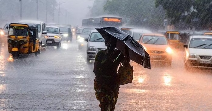
The India Meteorological Department (IMD) has issued a forecast indicating the likelihood of heavy rainfall across Kerala until November 28. The weather agency has implemented yellow and orange alerts for various districts in response to the prediction.
The current meteorological conditions involve a cyclonic circulation over interior Tamil Nadu and adjoining Kerala, extending up to 3.1 km above mean sea level. Additionally, another cyclonic circulation is expected to emerge over the South Andaman Sea and its surrounding areas around November 25. IMD anticipates the formation of a Low Pressure Area over the South Andaman Sea and neighboring regions by November 26, which is likely to move west-northwestwards and intensify into a Depression over the Southeast Bay of Bengal and adjoining Andaman Sea around November 27.
The IMD’s forecast outlines the following expectations for rainfall in Kerala:
From November 22 to 24: Rain or thundershowers are likely in most places.
From November 25 to 28: Rain is expected in many places across the state.
Specific alerts for heavy to very heavy rainfall have been issued for Palakkad and Idukki districts on November 22, with both districts placed on orange alert for the day.
The district-wise breakdown of alerts is as follows:
November 22: Thiruvananthapuram, Kollam, Alappuzha, Kottayam, Ernakulam, Thrissur, Palakkad Malappuram, Kozhikode, Wayanad
November 23: Thiruvananthapuram, Pathanamthitta, Idukki, Ernakulam, Wayanad
November 24: Ernakulam
IMD has also warned of thunderstorms with lightning and gusty winds, reaching speeds of 30-40 Kmph, likely to occur at one or two places in Kerala from November 22 to 24. Thunderstorms with lightning are predicted for one or two places in Kerala on November 25 and 26.
The heavy rainfall has already impacted the pilgrimage to the Sabarimala shrine, causing inconvenience to devotees and leading to flooding in various areas of Thiruvananthapuram district.